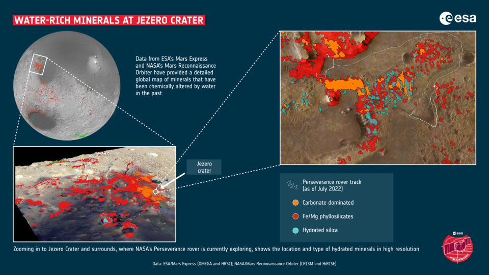
A new map of Mars is changing the way we think about the planet’s watery past, and showing where we should land in the future.
The map shows mineral deposits across the planet and has been painstakingly created over the last decade using data from ESA’s Mars Express Observatoire pour la Mineralogie, l’Eau, les Glaces et l’Activité (OMEGA) instrument and NASA’s Mars Reconnaissance Orbiter Compact Reconnaissance Imaging Spectrometer for Mars (CRISM) instrument.
Specifically, the map shows the locations and abundances of aqueous minerals. These are from rocks that have been chemically altered by the action of water in the past, and have typically been transformed into clays and salts.
On Earth, clays form when water interacts with rocks, with...
Read More


Recent Comments