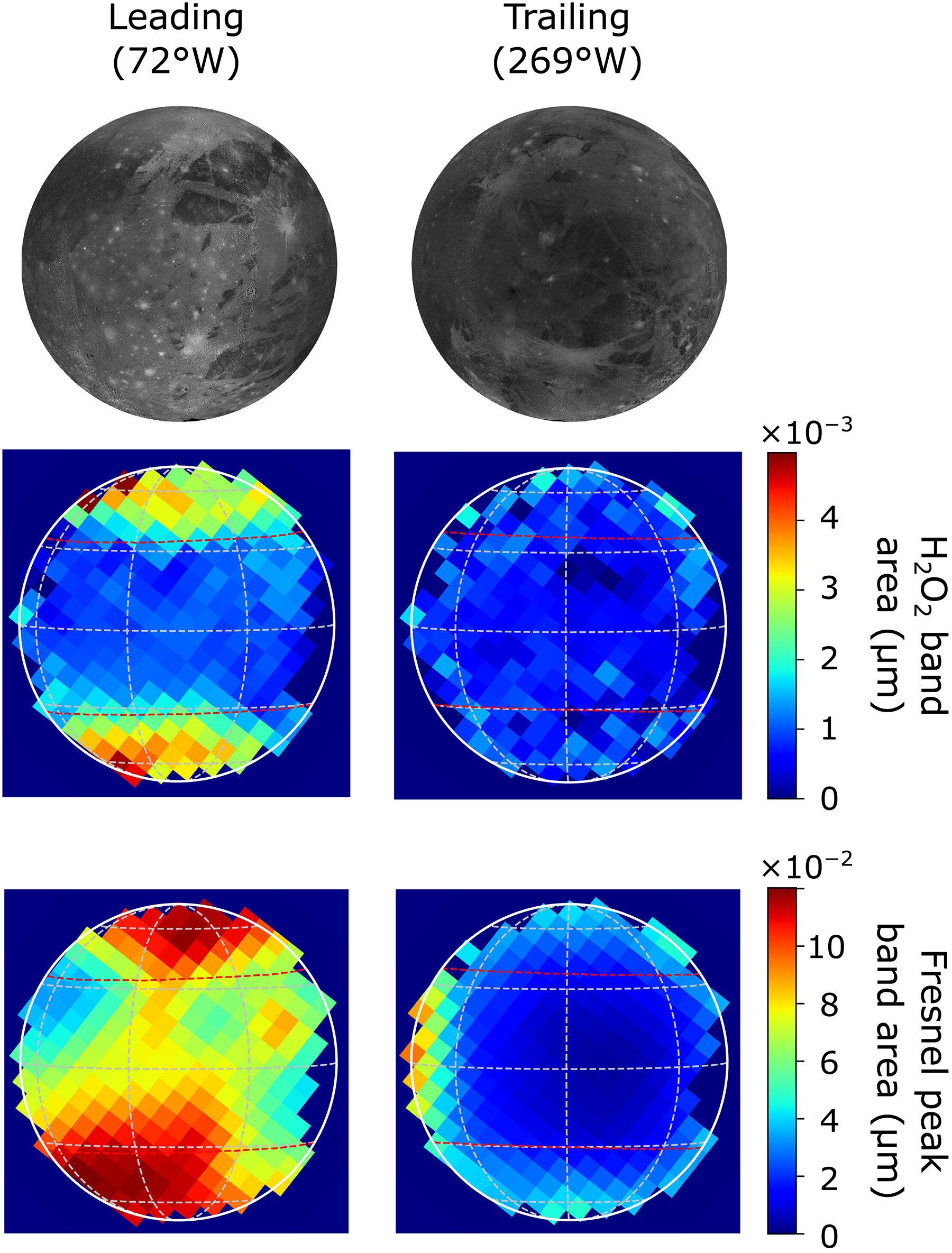
Maps of Ganymede’s 3.5 μm H2O2 absorption compared to those of the 3.1 μm Fresnel peaks of water ice and corresponding projections of the U.S. Geological Survey Voyager–Galileo imaging mosaic. H2O2 appears constrained to the upper latitudes, particularly on the leading hemisphere, which exhibits sharp boundaries at approximately ±30° to 35° latitude. These boundaries are roughly coincident with the onset of Ganymede’s polar frost caps and with the latitudes at which most of the impinging Jovian magnetospheric particles can access the surface. Maps of the Fresnel reflection peak of water ice, which generally track the distribution of ice deduced from shorter-wavelength water bands, also show the areas of greatest H2O2 on the leading hemisphere to be enriched in water ice...Read More

 Astronomy/Space


Recent Comments