


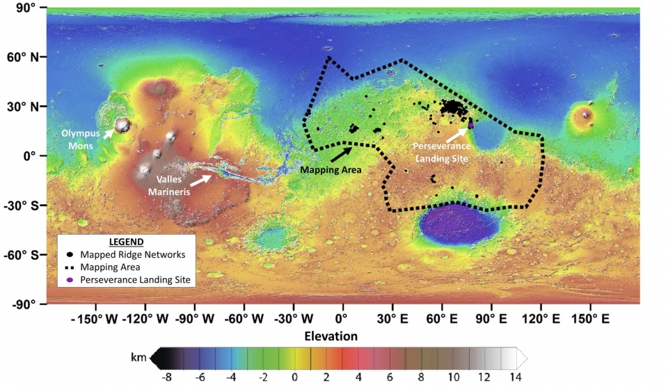
Over the last two decades, scientists have discovered unusual ridge networks on Mars using images from spacecraft orbiting the Red Planet. How and why the ridges formed and what clues they may provide about the history of Mars has remained unknown.
A team of scientists, led by Aditya Khuller of Arizona State University’s School of Earth and Space Exploration and Laura Kerber of NASA’s Jet Propulsion Laboratory, set out to learn more about these ridges by mapping a large area of Mars with th...
Read More

Recent Comments