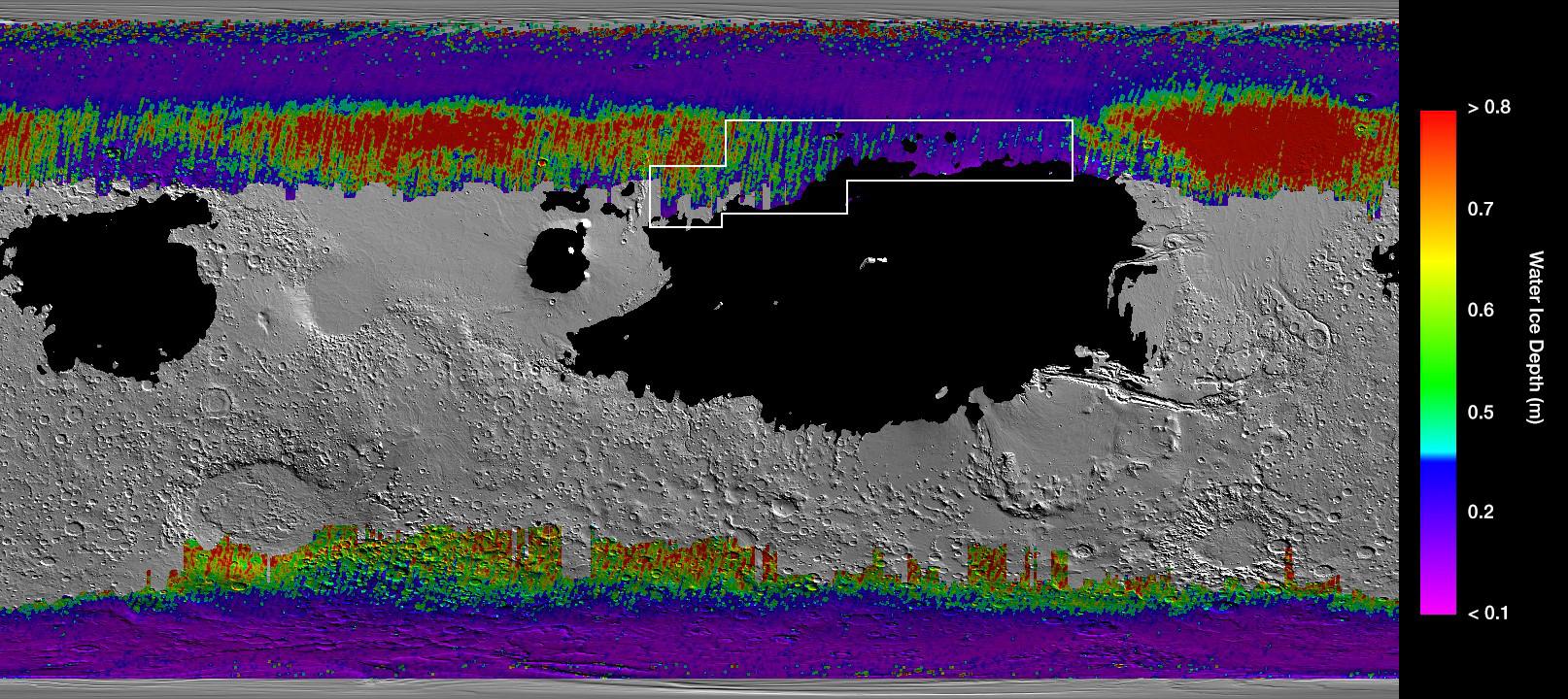
This rainbow-colored map shows underground water ice on Mars. Cool colors represent less than one foot (30 centimeters) below the surface; warm colors are over two feet (60 centimeters) deep. Sprawling black zones on the map represent areas where a landing spacecraft would sink into fine dust. The outlined box represents the ideal region to send astronauts for them to be able to dig up water ice.
NASA has big plans for returning astronauts to the Moon in 2024, a stepping stone on the path to sending humans to Mars. But where should the first people on the Red Planet land?
A new paper published in Geophysical Research Letters will help by providing a map of water ice believed to be as little as an inch (2.5 centimeters) below the surface.
A global dust storm completely obscured the surface of Mars. Images from May 28 and July 1. Credit: NASA/JPL-Caltech/MSSS
When dust filled the Martian atmosphere during the recent planet-wide dust storm, observations were plentiful – even from unlikely instruments. NASA’s Mars Reconnaissance Orbiter (MRO) provided the earliest insights on May 30 when it observed an accumulation of dust in the atmosphere near Perseverance Valley, where NASA’s Opportunity rover is exploring. The increasingly hazy storm, the biggest since 2007, forced Opportunity to shut down science operations by June 8, given that sunlight couldn’t penetrate the dust to power the rover’s solar panels. Scientists are anxiously waiting for the roving explorer to regain power and phone home.


Recent Comments