Mastcam tagged posts

Mars Rover continues progress along Upper Gediz Vallis Ridge

Sols 4159-4160: A fully loaded first sol
This image was taken by Chemistry & Camera (ChemCam) onboard NASA’s Mars rover Curiosity on Sol 4158 (2024-04-17 07:52:27 UTC). Credit: NASA/JPL-Caltech/LANL

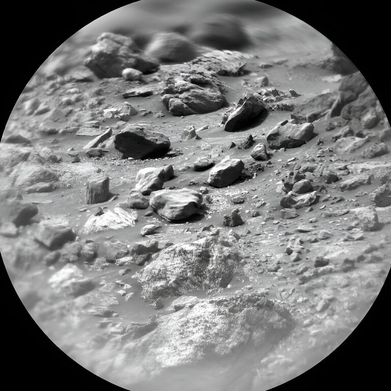
Curiosity continues to make progress along the margin of upper Gediz Vallis ridge, investigating the broken bedrock in our workspace and acquiring images of the ridge deposit as the rover drives south.

Today’s 2-sol plan focused on a DRT, contact science, and drive on the first sol, followed by untargeted remote sensing on the second sol. The team had to make some decisions at the start of planning about whether to drive on the first or second sol of this plan, and how that would affect the upcoming weekend activities.

As it turned out, the team was able to fit all of the desired contact science and remote sensing activities...

Read More

Full-Circle Vista from NASA Mars rover Curiosity shows Murray Buttes’

This 360-degree panorama was acquired by the Mast Camera (Mastcam) on NASA's Curiosity Mars rover as the rover neared features called 'Murray Buttes' on lower Mount Sharp. This 360-degree panorama was acquired by the Mast Camera (Mastcam) on NASA's Curiosity Mars rover as the rover neared features called "Murray Buttes" on lower Mount Sharp. The view combines more than 130 images taken on Aug. 5, 2016, during the afternoon of the mission's 1,421st sol, or Martian day, by Mastcam's left-eye camera. This date also was the fourth anniversary of Curiosity's landing. The dark, flat-topped mesa seen to the left of Curiosity's robotic arm is about 300 feet (about 90 meters) from the rover's position. It stands about 50 feet (about 15 meters) high. The horizontal ledge near the top of the mesa is about 200 feet (about 60 meters) across. An upper portion of Mount Sharp appears on the distant horizon to the left of this mesa. The relatively flat foreground is part of a geological layer called the Murray formation, which formed from lakebed mud deposits. The buttes and mesas rising above this surface are eroded remnants of ancient sandstone that originated when winds deposited sand after lower Mount Sharp had formed. Curiosity closely examined that layer -- the Stimson formation -- during the first half of 2016 while crossing a feature called "Naukluft Plateau" between two exposures of the Murray formation.

This 360-degree panorama was acquired by the Mast Camera (Mastcam) on NASA’s Curiosity Mars rover as the rover neared features called ‘Murray Buttes’ on lower Mount Sharp. This 360-degree panorama was acquired by the Mast Camera (Mastcam) on NASA’s Curiosity Mars rover as the rover neared features called “Murray Buttes” on lower Mount Sharp. The view combines more than 130 images taken on Aug. 5, 2016, during the afternoon of the mission’s 1,421st sol, or Martian day, by Mastcam’s left-eye camera. This date also was the fourth anniversary of Curiosity’s landing. The dark, flat-topped mesa seen to the left of Curiosity’s robotic arm is about 300 feet (about 90 meters) from the rover’s position. It stands about 50 feet (about 15 meters) high...

Read More