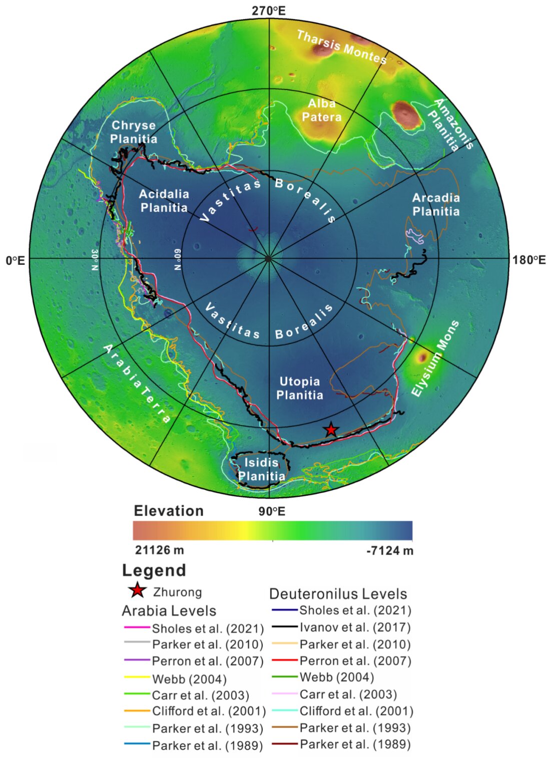
Topographic map of the northern hemisphere of Mars showing previously proposed shorelines. The red star denotes the location of the landing site of the Zhurong rover, ~282 km to the north of the Deuteronilus shorelines. The data are color-coded MOLA elevation over MOLA shaded relief centered at the North Pole with the Lambert azimuthal equal-area projection. Credit: Science China Press
An international research team led by Professor Long Xiao from the School of Earth Sciences of China University of Geosciences (Wuhan) has discovered the presence of marine sedimentary rocks on the surface of Mars for the first time by comprehensively analyzing the scientific data obtained by the multispectral camera (MSCam) carried by the Zhurong rover...
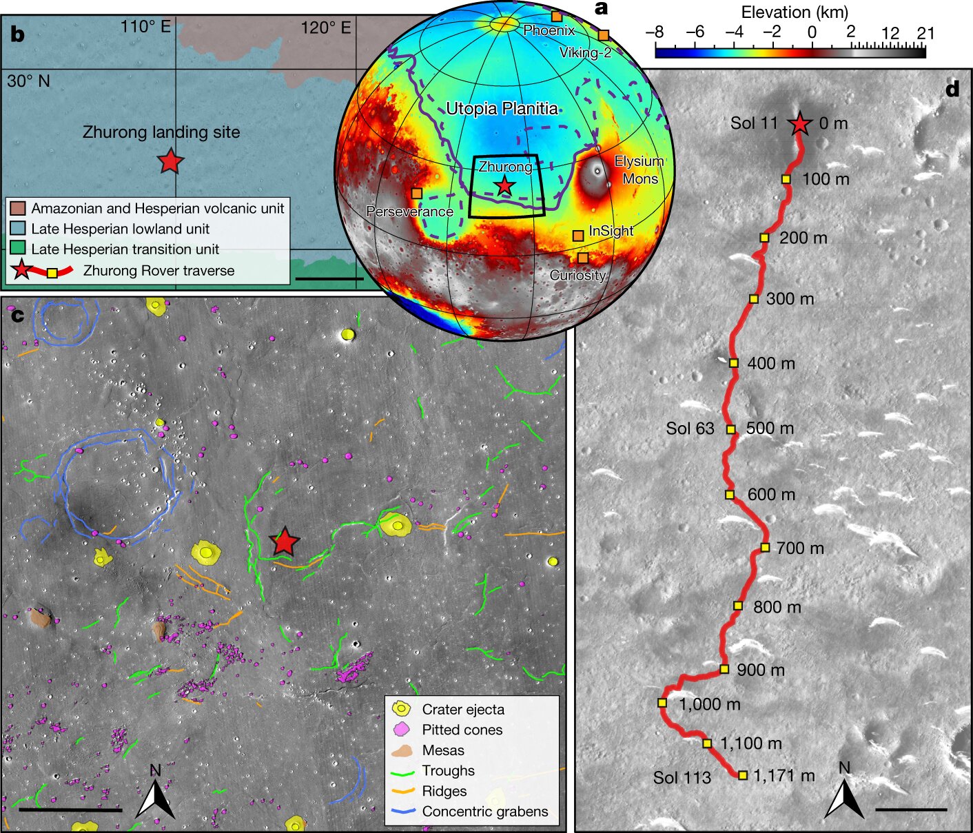
Region around the Zhurong rover landing site. a, Topographic map showing the landing site of Zhurong (red star), as well as the landing sites of the Phoenix, InSight, Curiosity, Perseverance and Viking-2 landers/rovers (orange squares). The purple solid and dashed lines show the locations of Martian palaeoshorelines of ref. 11, roughly delineating the depositional contact of the VBF in the northern plains. b, Simplified geological map near the Zhurong landing site with data from ref. 18. Scale bar, 200 km. c, Geomorphic map of the Zhurong landing area with data from ref. 22. Scale bar, 15 km. d, Traverse of the Zhurong rover from 25 May (Sol 11) to 6 September (Sol 113) 2021 on the basemap of a Tianwen-1 High Resolution Imaging Camera image (Sol 19, 2 June 2021)...Read More


Recent Comments